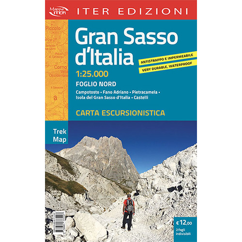

Gran Sasso d’Italia
Foglio Nord
- Campotosto
- Fano Adriano
- Pietracamela
- Isola del Gran Sasso d’ Italia
- Castelli
Foglio Sud
- Farindola
- Assergi
- Castel del Monte
- Santo Stefano di Sessanio
- Calascio
- Ofena
- Villa Santa Lucia degli Abruzzi
The brand new hiking map of the Gran Sasso d’Italia in 1:25,000 scale, in tear-proof and waterproof material, is an indispensable tool for all outdoor lovers: hikers, mountaineers, trekking and mountain bike enthusiasts. Hundreds of kilometers of trails are represented to explore the heart of the National Park. Furthermore, the map shows the indication of managed refuges (Rifugio Duca degli Abruzzi, Rifugio Franchetti, Rifugio Cima Alta) and non-managed ones, ski facilities, rest areas and camping sites. Itineraries for all tastes and all legs: from walks to reach Rocca Calascio to excursions leading to Monte San Franco, to Pizzo Cefalone, to Monte Aquila and to Brancastello. There is no shortage of via ferratas (Ventricini, Brizio, Danesi, Bivacco Bafile) and challenging routes bordering on mountaineering (Sentiero del Centenario, Via dei Laghetti, Via Brancadoro, Via Cieri, Via delle Creste) to conquer the peaks of Mount Informace, of Monte Prena and Monte Camicia or the giants of the Central Apennines: Corno Grande and Corno Piccolo.
Editions: Iter
Hiking Map
Scale: 1:25.000
Year: 2022
Italian language
ISBN: 9788881773107


Reviews
There are no reviews yet.