
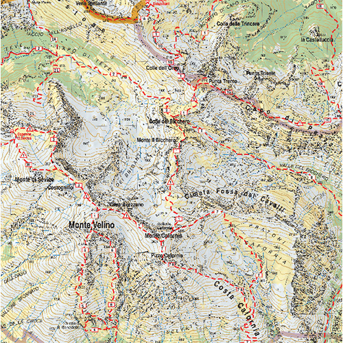
Monte Velino
Altopiano delle Rocche – Monti della Duchessa
Le aree presenti nella carta
- I monti della Duchessa
- Campo Felice
- I monti di Ocre
- Il massiccio del Velino
- La Magnola
- L’altopiano delle Rocche
- La Serra di Celano
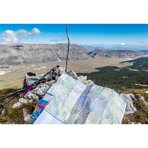
The topographic and hiking map of Monte Velino, 1:25,000 scale, practical and resistant, shows with the utmost care the path network of the Velino massif and the surrounding areas: the Duchessa mountains, Campo Felice, the Ocre mountains, the Magnola , the Rocche plateau, the Serra di Celano. Precious tool for the hiker who wants to venture into the magnificent nature of one of the most beautiful areas of Abruzzo. Detailed and updated cartography, easy to consult, indicates all the numbered CAI and GEV paths and the recommended routes for trekking and mountain biking. The map of Monte Velino also includes all the useful information for outdoor enthusiasts (shelters, ski resorts, cycle paths, wildlife areas, riding stables, campsites and rest areas, museums, castles). All itineraries were recorded with the GPS and checked with cartographic software in a GIS environment, to offer the greatest possible precision.
Edtions: Iter
Hiking Map
Scale 1:25.000
Year: 2016
Language: Italian
ISBN: 9788881772261
Reviews
There are no reviews yet.