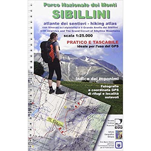
Atlas of the paths of the Sibillini Mountains with ski mountaineering itineraries.
The 1: 25,000 scale hiking map is collected in pages, which can be easily consulted even in strong wind conditions and with the coordinates on the edges for immediate use of the GPS.
Index of names for a quick search of places, sources, refuges and inhabited centers.
Photo album of refuges, peaks, saddles and notable locations with GPS coordinates.
Hiking and ski-mountaineering itineraries to the peaks and tourist resorts.
Restaurants, hotels, agritourisms, hostels, landlords in the park.
Publisher: SER Società Editrice Ricerche
Author: Alberico Alesi, Maurizio Calibani, Antonio Palermi, Enrico Vallorani
Publication: June 2011
Format: 15 x 23 cm
Type: Atlas
Language: Italian
Scale: 1:25.000

Reviews
There are no reviews yet.